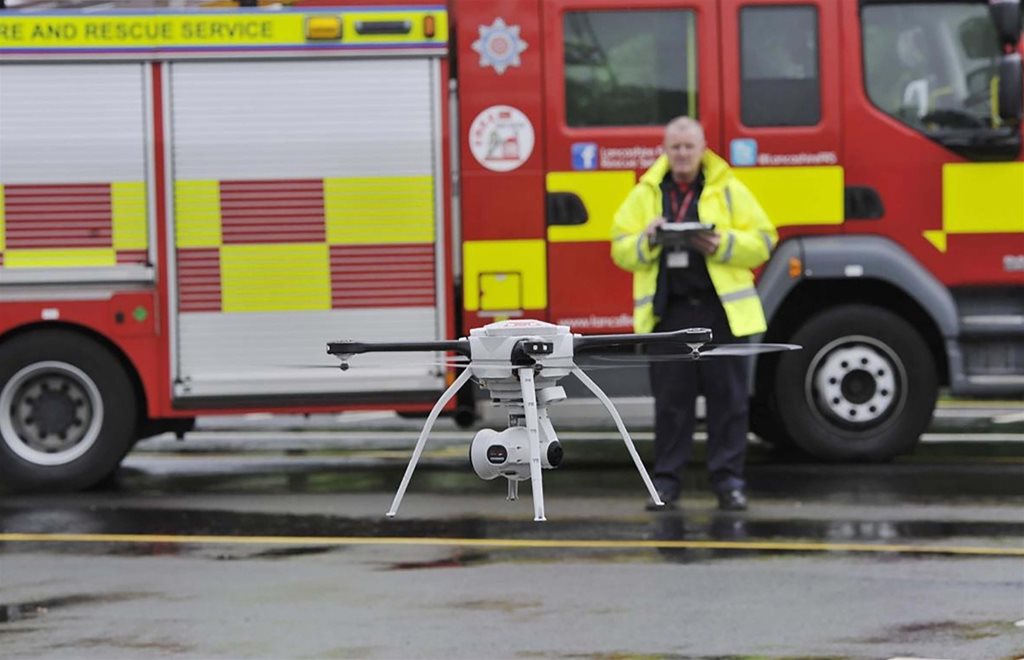
Drone technology offers emergency services a new perspective for more informed decision making and assessments, says MCL
THE USE of drones, or unmanned aerial vehicles (UAVs) as they are also known, for recreational and photography use is now well established in the UK, with the technology becoming part of everyday life. Even retailers such as Amazon are looking at how it can be used to revolutionise parcel delivery, and UAVs are also widely used by the military to support surveillance and offensive operations.
In the extreme and pressured environments that fire and rescue services (FRSs) respond to, the technology can be a vital tool in providing firefi ghters with a greater understanding of the cause and spread of large fires, developing
more informed risk assessments, and helping to identify risks to enable improved decision making in firefi ghting operations.
Compatible with a variety of surveillance payloads, drones can act as a ‘third eye’ positioned metres up in the air, enhancing the effectiveness and safety of crews on the ground, and mitigating associated risks to prevent threat to life, property or surrounding areas. But in which situations and environments can UAVs prove useful?
Responding to fires
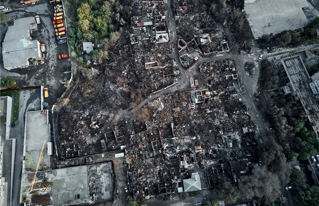
For fires in both rural and urban environments, the use of drone technology can be extremely beneficial. For example, Lancashire Fire and Rescue Service (LFRS) uses the Aeryon SkyRanger UAV to gain an instant overview of fi res as they develop and spread. This vital information can then be used to position equipment and crews on the ground to tackle the flames more effectively.
Commenting on the service’s use of the SkyRanger, Chris Rainford, drone safety manager at LFRS, said: ‘Using the drone we can get an instant overview of a whole fire in less than fi ve minutes, and start moving our machines and our firefi ghters around just like chess pieces – all controlled by drone footage. It also brings us a massive benefit in that we can see fires as they’re developing.’
Not only can drones improve the speed and efficiency of controlling and extinguishing fires, but they also allow FRSs to safely manage crews on the ground, identifying risks to nearby people or buildings as well as routes to and from the affected area. This level of situational awareness can then be used to forward plan and predict the fire’s direction of travel to inform the FRS and its evacuation strategies.
In urban settings, where buildings are typically taller, being able to view the fire from the outside of the building on a level plane can provide a more insightful view of the direction of travel of the fire, the building areas affected and, most importantly, help identify people within the property. Using this real time information, fire crews can make decisions based on detailed insight, and deploy resource effectively within a building.
Mitigating the risk to emergency responders is also a key benefit of using UAV technology. For environments where there may be falling debris or other hazards, such as chemicals or gas cannisters, drones can be flown over and
around buildings to allow for FRS commanders to assess the situation before committing crew or equipment to specific areas.
Missing persons
LFRS also uses the SkyRanger for search and rescue, using its high definition zoom and thermal imaging camera for missions during the day and night. The technology has been effectively used to locate people in water, quarries and other challenging locations – a mounted camera can zoom in on a face up to half a mile away and provide a clear image to help identify the person along with surrounding risks such as falling cliff debris.
For more rural areas or where a vulnerable person goes missing, the ability to narrow down the search field by using an attached thermal imaging camera to identify a person in a heavily wooded area, or at night, is crucial. Monitoring of this kind helps reduce time intensive and vast search operations by allowing search teams to be deployed more efficiently in the area where the heat source is detected.
Emergency collaboration
The situational awareness and perspective that a drone provides is essential for circumstances that require the successful collaboration of the emergency services and other government or agency organisations.
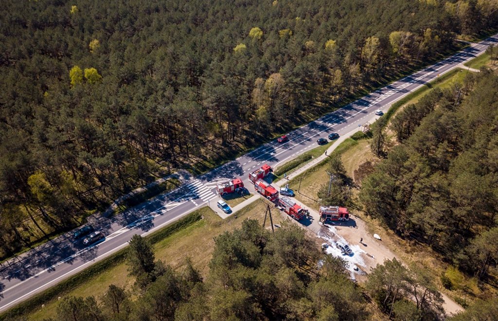
Road traffic accidents are a prominent example of this, as not only can the drone follow the path of the vehicle to capture vital evidence left at the scene, but it can also be used to identify the risk of further accidents while the road is closed and traffic behind is building up.
By providing a holistic view of the surrounding road networks, authorities can effectively put diversions in place to reduce the risk of further collisions, and the real time feed can also help guide emergency responders to and from the scene using the quickest routes possible. UAV technology is able also to benefit emergency services that are handling natural disasters, given that those situations require fast acting collaborative measures.
Flooding and nuclear or chemical accidents are situations in which the use of drone technology could be vital in measuring radiation, tracking the spread of harmful chemicals or gases and identifying people who are trapped in the
surrounding areas.
In these extreme circumstances where the health and safety of people responding to the incident and of those caught up in the disaster is of paramount importance, the aerial view from the drone can highlight areas in need of
immediate aid and enable services to identify passable escape routes.
Major events
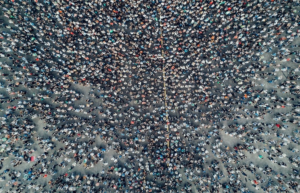
FRSs, in collaboration with other emergency services and state organisations, are crucial to ensuring security and safety at large events where gatherings of large numbers of people present risks.
From a crowd management perspective, UAV technology can prove useful for highlighting pathways with capacity and routes that are becoming problematic where the flow of people needs to be monitored and crowds directed accordingly. In the event of a major incident, the drone fulfils an essential role by directing first responders to any incidents using a real time feed of the surrounding area and crowd movements. For medical emergencies, the time saving that this data provides can make a life or death difference to the person requiring medical attention.
In addition, UAV technology can be a vital tool during a marauding terrorist attack. The thermal camera and agile nature of a drone can track the assailant through a crowd, identify the routes to and from the scene and provide a perspective on the nearby crowds that need to be managed towards safety.
In collaboration with the police and other responding organisations, the aerial viewpoint can identify routes and risks that are not clearly visible on the ground, and allow the services to plan accordingly.
Extreme environments
A major benefit to the FRSs of using UAV technology to relay live video is that the drone can withstand extreme environments that could pose a risk to FRS personnel.
With an extended flight time, UAVs offer high definition video and an extended flight range which ensures that the devices can operate reliably on long missions in harsh and dynamic environments.
Proven in both military and commercial deployments, drones have the ability to operate in 65km sustained winds and 90km gusts. The SkyRanger device is also used by the British Antarctic Survey and can withstand freezing temperatures as well as the dry and arid conditions of deserts, so it is well placed to deal with the varying conditions that FRSs face in the UK.
Drone technology presents both UK FRSs and the broader emergency services with a vital new perspective, which allows commanders on the ground to make more informed decisions. Effectively helping to manage the risk for FRS crews and civilians along with the risks for the surrounding area, the aerial insight provided by drones means that firefighters and their equipment can be deployed efficiently to bring the situation to the most positive conclusion
MCL is a supplier of advanced electronic communications, information systems and signals intelligence technology to the defence and security sectors